

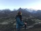
Trekking in India
India Trekking Packages | Duration | Price |
|---|---|---|
| Hampta Pass Trek, Manali | 5 days & 4 nights | USD 86.7 |
| Valley of Flowers Trek with Hemkund Sahib, Uttarakhand | 6 days & 5 nights | USD 75.14 |
| Har Ki Dun Trek, Uttarakhand | 7 days & 6 nights | USD 114.44 |
| Dayara Bugyal Trek Uttarakhand | 4 days & 3 nights | USD 63.58 |
| Kedarkantha Trek, Uttarakhand | 5 days & 4 nights | USD 63.58 |
| Brahmatal Trek, Uttarakhand | 6 days & 5 nights | USD 75.13 |
| Kuari Pass Trek from Joshimath | 6 days & 5 nights | USD 92.36 |
| Sandakphu Trek | 6 days & 5 nights | USD 106.93 |
| Goechala Trek, Sikkim | 10 days & 9 nights | USD 208.07 |
| Gaumukh Tapovan Trek, Uttarakhand | 7 days & 6 nights | USD 225.42 |
| Rupin Pass Trek, Uttarakhand | 8 days & 7 nights | USD 210.39 |
| Pangarchula Peak Trek with Kuari Pass | 7 days & 6 nights | USD 106.93 |
Chadar Trek, Brahmatal Trek, Kedarkantha Trek, Har Ki Dun Trek, Sandakphu Trek, Valley of Flowers Trek, Tarsar Marsar Trek, Hampta Pass Trek, Rajmachi Trek Maharashtra, Ratangad Trek Maharashtra and many more.
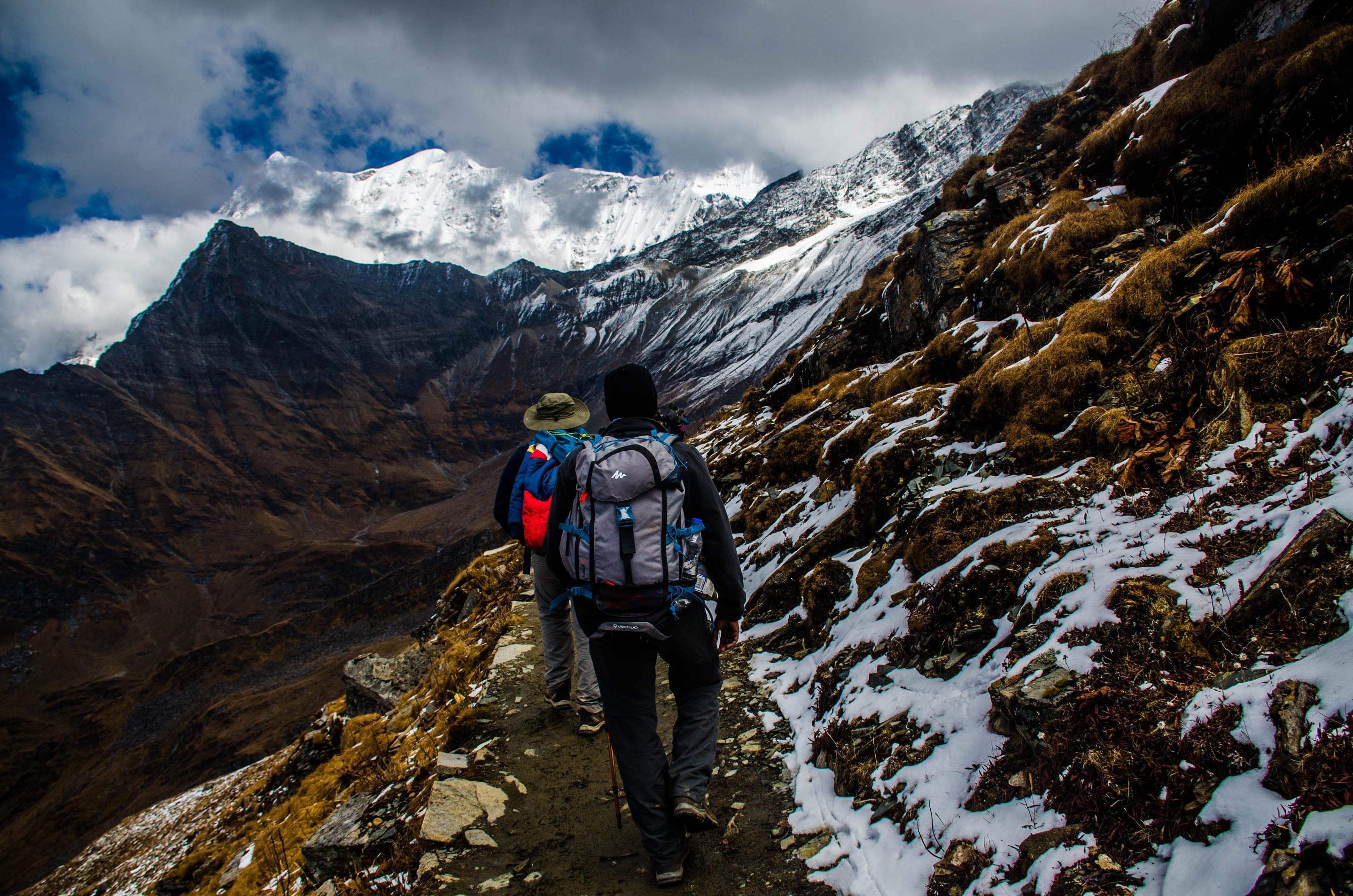
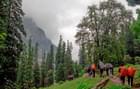
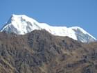
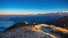
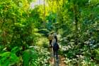
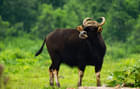
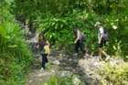
All over India, there are magnificent landscapes and whether you are a seasoned explorer or a new adventurer, you will always find places suitable for trekking in India. India is home to the highest mountain range in the world, the Himalayas, but this is not all. There are several trekking trails through hills, valleys, and tropical rainforests. With varying difficulty levels and terrains, these treks are sure to provide you with the much-needed thrill.
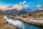
Treks in India are a great way to enjoy the natural splendour of the country and experience the real thrill of mountains. There are four main areas for trekking in this country, out of which three are located around the Himalayas. These are Himachal Pradesh, Uttarakhand, and Jammu and Kashmir. Some of the most magnificent treks here are the Chadar trek, Roopkund Trek, Stok Kangri Summit, etc.
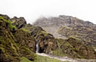
Not all the places for trekking in India are in the north, however, and the southern state of Kerala presents several trekking opportunities as well. Chembra Trek, Kudremukh trek as well as Kodachadri offer the best trekking experience. If you are up for some excitement during your vacation, nothing can beat trekking through lush greenery to catch the breathtaking views of the mountain.
Best Selling Himalayan Treks
1. Chadar Trek:
One of the most popular destinations for trekking in India, experience the unique Chadar Trek in Ladakh's Zanskar region,where the thrill of walking on a frozen river awaits you. At an elevation of 11,123 feet, this trek is considered difficult and is a test of endurance and willpower. It is not just about the challenging terrain; the frigid temperatures add to its difficulty. This trek is a unique blend of cultural immersion as you encounter local Zanskari villages and marvel at the ice formations and stark, serene landscapes.
Trek Difficulty: Hard
2. Brahmatal Trek:
Discover the enchanting beauty of Uttarakhand's Chamoli district through the Brahmatal Trek. This moderately difficult trek is a magical blend of grand Himalayan views and the tranquil Brahmatal Lake. Rising from 7,677 to 12,250 feet, this trek suits both novices and experienced trekkers. Along the way, you will traverse lush forests, witness the majestic peaks of Trishul and Nanda Ghunti, and explore hidden corners of the Himalayas.
Trek Difficulty: Moderate
3. Kedarkantha Trek:
The Kedarkantha Trek in Uttarkashi district is a quintessential Himalayan experience and a gem among treks in India. With elevations between 6,000 and 12,500 feet, this trekking experience is suited for beginners as well as for experienced trekkers. The trek also offers breathtaking views of famous peaks like the Swargarohini, Bandarpoonch, and Black Peak. The trek is renowned for its beautiful campsites, serene Juda-Ka-Talab lake, and the charming Himalayan villages you pass through. It is an ideal trek for those looking to experience the grandeur of the mountains without an arduous climb.
Trek Difficulty: Easy to Moderate
4. Har Ki Dun Trek:
In the Garhwal region of Uttarakhand lies the Har Ki Dun Trek, a journey through alpine meadows and ancient villages. This trek, considered easy to moderate, with elevations ranging from 6,000 to 11,700 feet, is known for its picturesque landscapes and rich biodiversity. You will pass through lush green valleys and pine forests and get a glimpse of the local Garhwali culture. It is a trek that combines natural beauty with cultural insights, suitable for trekkers to experience a good climb and simultaneously immersing in the cultural experiences of the region.
Trek Difficulty: Easy to Moderate
5. Sandakphu Trek:
Sandakphu, the highest peak bordering West Bengal and Nepal’s Ilam district, is also one of the most renowned trekking places in India, and the expedition to the place offers a blissful journey to the highest point in West Bengal. With elevations from 6,400 to 11,950 feet, Sandakphu trek is a moderately challenging trek, and is famous for the panoramic views of the Himalayan giants – Everest, Kanchenjunga, Lhotse, and Makalu. The trek takes you through rhododendron forests and charming villages, offering a blend of natural beauty and cultural exploration.
Trek Difficulty: Moderate
Planning A Trip to Manali, Checkout Our Winter Treks in Manali Now!
6. Valley of Flowers Trek:
The Valley of Flowers Trek in Uttarakhand's Chamoli district is a UNESCO World Heritage Site. It is famous for its endemic alpine flowers and diverse fauna like the Asiatic black bear and snow leopard. This trek, ranging from 6,234 to 14,400 feet, is moderate but requires good physical fitness. The trek also includes visiting the sacred Hemkund Sahib beside a picturesque lake. It is a journey that combines spiritual and natural explorations, making it a truly unique experience.
Trek Difficulty: Moderate
7. Tarsar Marsar Trek:
The Tarsar Marsar Trek in Jammu and Kashmir's Pahalgam region is a representation of one of the most beautiful Indian trekking places. The trek, ranging between 7,874 and 13,201 feet, is considered easy to moderate. It takes you through the mesmerising twin lakes of Tarsar and Marsar, nestled amidst the pristine beauty of the Kashmir Valley. The trek offers stunning views of the Kolahoi Peak and a chance to experience the untouched beauty of Kashmiri landscapes. It also rewards trekkers with unparalleled natural beauty and tranquillity.
Trek Difficulty: Easy to Moderate
8. Hampta Pass Trek:
The Hampta Pass Trek in Himachal Pradesh's Kullu Valley is a spectacle of contrasting landscapes. Ranging from 8,530 to 14,035 feet, this easy-to-moderate trek traverses through lush green valleys and barren landscapes and ends at the beautiful Chandratal Lake. It also offers a varied terrain, from dense pine forests to open meadows and high-altitude deserts, making it a diverse trekking experience. It is an excellent option for those looking to experience the varied landscapes of the Himalayas in one trek.
Trek Difficulty: Moderate
Top Selling Treks In Central India
1. Rajmachi Trek, Maharashtra:
Rajmachi Trek, located in Maharashtra's captivating Sahyadri range, is among the most unique treks in India. Starting from the quaint village of Udhewadi, this easy trek takes about 2-3 hours to reach the summit at 2710 feet. It is ideal for beginners and nature lovers. You encounter lush forests, ancient Buddhist caves, and two fortified peaks, Shrivardhan and Manaranjan forts, along the way. The trek offers a remarkable mix of historical structures and panoramic views of the Western Ghats, making it a must-visit for trekking enthusiasts.
Trek Difficulty: Easy
2. Ratangad Trek, Maharashtra:
The Ratangad Trek, located in Maharashtra's Western Ghats, is a journey through history and nature. Starting from the base village of Ratanwadi, the trek to the summit at 4255 feet takes around 3-4 hours and is of easy-to-moderate difficulty. This route is known for its historical Ratangad Fort, dating back to the Maratha empire, and the ancient Amruteshwar Temple. The trek provides a thrilling adventure with its rugged terrain and breathtaking views of surrounding peaks and the Bhandardara dam.
Trek Difficulty: Easy to Moderate
Looking for a Weekend Trek in Manali, Checkout Our Manali Weekend Treks Now!
3. Kalsubai Trek:
Kalsubai Trek, situated in the Western Ghats of Maharashtra, stands as the highest peak in the state at 5400 feet. Known as the 'Everest of Maharashtra', this moderate trek is one of the most popular treks in India, and is a blend of challenging and exhilarating experiences. It typically takes 3-4 hours from the base village of Bari. The trek is a physical challenge and a cultural adventure, with the Kalsubai Temple at the summit drawing pilgrims all year round. It offers panoramic views of the Sahyadri ranges and a chance to experience an unforgettable sunrise.
Trek Difficulty: Easy to Moderate
4. Harihar Fort Trek:
Harihar Fort Trek in the Western Ghats of Maharashtra blends thrill and beauty. The trek to this unique fort at 3676 feet, known for its steep rock-cut stairs, takes about 2-3 hours from Nirgudpada village. It is a relatively easy trek and provides a thrilling experience for adventurers. The summit offers a stunning view of the surrounding landscape, including the Vaitarna reservoir and Brahmagiri mountains. The fort's historical significance and architectural marvel make it a fascinating destination.
Trek Difficulty: Easy
5. Sandhan Valley Trek:
Sandhan Valley Trek, situated in Maharashtra's Western Ghats, is among the most remarkable trekking places in India. Known as the 'Valley of Shadows', it stretches for about 2 km with a depth of around 150 feet. This 4-5 hour trek from Samrad village is of high difficulty, offering an adventure through narrow gorges, water-carved rock faces, and natural pools. It is an experience combining trekking, camping, and rappelling. The trek culminates with views of high cliffs and deep valleys, making it a unique and enthralling experience.
Trek Difficulty: Hard
Top Selling Treks in South India
1. Kudremukh Trek, Karnataka:
Kudremukh Trek in Karnataka is among one of the standout treks in India. Taking you to an elevation of 4,829 feet, this moderate trek, starting from Chikmagalur, lasts 2-3 hours. It is renowned for its rich biodiversity, and the path winds through dense shola forests, leading to the Kudremukh Peak, which resembles a horse's face. The trek offers breathtaking views of rolling hills and the chance to spot diverse wildlife, making it a haven for nature enthusiasts and wildlife photographers.
Trek Difficulty: Moderate
2. Makalidurga Trek:
Located near Bangalore, the Makalidurga Trek is an easy climb, perfect for beginners. Spanning 1-2 hours from the base village, the trek makes you reach the top at an elevation of 4,300 feet. The trek is known for its historic Makalidurga Fort, situated atop a granite hillock. The route offers scenic views of a nearby lake and the surrounding greenery, making it a popular choice for day trekkers and those interested in exploring the region's rich history and natural beauty.
Trek Difficulty: Easy
3. Kodachadri Trek:
The Kodachadri Trek in Karnataka is one of the most diverse treks in India, leading you to an elevation of 4,629 feet. Starting from Sringeri, this moderate trek takes about 1-2 hours. It is famous for its dense forests and the scenic Hidlumane Falls en route. The summit provides a stunning view of the Arabian Sea, the Western Ghats, and the beautiful Kodachadri Falls. The trek also includes the historical Sarvajna Peetha, a small temple at the top, adding a spiritual element to the adventure.
Trek Difficulty: Moderate
4. Tadiandamol Trek:
Tadiandamol Trek, near Nandi Hills in Karnataka, offers an easy trail for beginners. The trek, taking about 1-2 hours from the base, ascends to 4,629 feet. It is famous for its scenic beauty, featuring vast expanses of Shola forests and the opportunity to witness the mesmerising Tadiandamol Falls. The peak offers panoramic views of the surrounding landscape, making it a favourite among photographers and nature lovers.
Trek Difficulty: Easy
5. Uttari Betta Trek:
The Uttari Betta Trek near Ramanagara in Karnataka is one of the most fascinating trekking places in India. This moderate trek, spanning 1-2 hours, leads to an elevation of 4,870 feet. The trek includes a walk through seven doors leading to the fort, offering a glimpse into the region's history. The summit provides spectacular views of the Western Ghats and surrounding landscapes like the Uttari Betta Falls. It is a popular trek for witnessing sunrise and sunset, attracting both nature lovers and photography enthusiasts.
Trek Difficulty: Moderate
6. Savandurga Trek:
Located near Savandur in Karnataka, the Savandurga Trek is an easy trek, ideal for beginners. The trek starts from the base village of Savandur and takes about 1-2 hours to reach the summit at 4,320 feet. Known for having one of Asia's largest monoliths, the trek offers a unique experience with views of the Arkavathi River. The trek’s summit includes the ruins of Savandurga Fort, providing a historical element to this scenic trek. It is perfect for those interested in geological formations and historical exploration.
Trek Difficulty: Easy
Looking For A Beginner's Trek in Manali, Checkout Our List Of Easy Treks in Manali.
7. Kunti Betta Sunrise Trek:
Near Mysore in Karnataka, the Kunti Betta sunrise trek is a celebrated spot among India’s trekking places. This easy trek starts from the base village of Kunti Betta and takes 1-2 hours to reach 4,023 feet and is ideal for beginners. Famous for its picturesque sunrise views from the top, it also includes mythological significance, as it is believed to be a place visited by the Pandavas. The trek passes through lush terrain, offering serene views of paddy fields, the Kunti Betta Temple and the Thonnur Lake, making it a perfect spot for nature lovers.
Trek Difficulty: Easy
8. Channagiri Trek:
Channagiri Trek, near Bangalore in Karnataka, offers a moderate-level trek suitable for experienced trekkers. Starting from the base village of Channagiri, the trek takes about 1-2 hours to reach the summit at 4,512 feet. This trek is known for its dense forest cover and offers stunning views of Nandi Hills and surrounding areas. The trek leads to the Channagiri Temple at the summit, blending the adventure with spiritual essence. It is an ideal trek for those seeking tranquillity away from the city.
Trek Difficulty: Moderate
India Trekking Packages
.jpg?w=340&dpr=2)
.png?w=340&dpr=2)


Hampta Pass Trek, Manali


Valley of Flowers Trek with Hemkund Sahib, Uttarakhand
.jpg?w=340&dpr=2)


Har Ki Dun Trek, Uttarakhand


.jpeg?w=340&dpr=2)


Kuari Pass Trek from Joshimath


Sandakphu Trek


Goechala Trek, Sikkim


Gaumukh Tapovan Trek, Uttarakhand


Best Trekking Destinations


Our Partners
Newly Added Experiences


Tourism Board Alliances
India Trekking FAQs
Which month is best for trekking in India?
The months for the best trekking in India experience depend on the region. In the Himalayas, the best months are generally May to June and September to October. These months offer clear skies, moderate temperatures, and lush landscapes. You can witness the natural beauty of the mountains during these months.
Book Now: Kheerganga Trek
How much does trekking cost in India?
The cost of the best treks in India typically starts from INR 5200 and can go up to INR 65,000. However, the price of the treks depends on the duration, location, and services. The cost of the trekking also includes additional expenses like gear rental, permits, and guide fees.
Check Out & Book: Nag Tibba Trek
Which is the toughest trek in India?
One of the toughest trails for trekking in India is the Pin Parvati Pass Trek in Himachal. It is renowned for its challenging terrain and high-altitude crossing. Another challenging trek in India is Kalindi Khal Trek in Uttarakhand. Here, trekkers navigate through glaciers and steep mountain passes.
Checkout Now: Trek to Bandaje Falls
How difficult is trekking in India?
Trekking in India varies in difficulty based on the chosen route. Some treks like the Valley of Flowers trek in the Chamoli district are perfect for beginners, while the Chadar Trek in Ladakh can be extremely challenging for trekkers. Proper preparation, fitness, and caution are essential for a safe and enjoyable trekking experience.
Explore Now: Beach Trek Gokarna
Which is the longest trek in India?
One of the longest and best treks in India is the Lawan Glacier Trek in Dhappa. The total distance of this trek is 103.5 kilometres and the duration is 14 days. Another long trek in India is Liam Trek in Teejam. The trek is 116.7 kilometres long and the total duration of the trek is 10 days.
You can also explore: Anthargange Night Trek
Which are the best treks in Uttarakhand?
1. Roopkund Trek: Roopkund Trek in Uttarakhand is one of the best trekking in India that takes you to the beautiful Roopkund Lake.
2. Valley of Flowers Trek: The Valley of Flowers trek is considered one of the easiest India treks that is perfect for beginners. It is a journey through vibrant blooms and peaceful meadows, allowing you to immerse yourself in nature.
3. Har Ki Dun Trek: Har Ki Dun Trek offers a serene escape into untouched villages and dense forests.
4. Kedarkantha Trek: Kedarkantha Trek is one of the best treks in India for winters. It is perfect for beginners with easy trails leading to mesmerising views of snow-capped Himalayas.
Which are the best treks in Himachal Pradesh?
1. Hampta Pass Trek: Hampta Pass offers one of the most beautiful experiences of trekking in India known for its green valleys and snowy mountains.
2. Pin Parvati Trek: Pin Parvati Trek challenges adventurers with remote valleys and high-altitude passes.
Kheerganga Trek: Kheerganga Trek is one of the popular India treks renowned for its rejuvenating hot springs nestled amidst lush forests.
3. Beas Kund Trek: Beas Kund Trek leads to a serene lake surrounded by towering peaks, showcasing the natural beauty of the Himalayas.
4. Triund Trek: Triund Trek, perfect for beginners, offers easy trails with breathtaking views of the Dhauladhar range and scenic landscapes.
Which are the best treks in Kashmir?
1. Kolahoi Glacier Trek: Kolahoi Glacier Trek in Kashmir is one of the most thrilling trekking in India experiences which takes you through icy landscapes and rugged terrain.
2. Naranag Gangabal Trek: Naranag Gangabal Trek is one of the beautiful India treks which leads to a serene lake nestled amidst majestic mountains.
3. Kashmir Great Lakes Trek: Kashmir Great Lakes Trek features pristine alpine lakes, lush meadows, and snowy peaks. You can immerse yourself in the mesmerising scenery here and experience the tranquillity of nature amidst picturesque landscapes.
4. Tarsar Marsar Trek: Tarsar Marsar Trek delights with twin lakes amid lush valleys and towering mountains.
Which are the best treks in the Western Ghats?
Kodachadri Trek: These hills in the Western Ghats lie at an elevation of 4411 feet above sea level. The trekking trail begins from the South Kanara Forest. Even newbie trekkers can undertake this journey as it mostly covers a low altitude forest landscape.
Chembra Peak Trek: This is one of the best trekking places in India located close to the town of Meppadi. It is the highest peak in the Wayanad Hill Range, with an altitude of 2000 metres.
Ratangad Fort Trek: This is a 400-year old fort that was once captured by the Maratha King Shivaji. The trek starts from the base village of Ratanwadi and ends at a tip known as the eye of the needle.
Kudremukh Trek: Kudremukh is a part of several trekking tours in India, with its diverse trekking trails and landscapes. After reaching the peak, you get a splendid view of the clouds and skies lying over the Arabian sea.
Which are the best treks in South India?
Chimmini: This is a wildlife sanctuary in the Thrissur district of Kerala. If you are an avid bird watcher, then this is definitely one of the best trekking places in India for you. Here you will get to see 160 different bird species, moths, and insects.
Kodachadri: Kodachadri is one of the most difficult places for trekking in India and it requires you to be physically fit. The journey takes around 7-8 hours but after completing the trek you can catch a gorgeous view of the Arabian Sea.
Kolli Hills: Kolli Hills in Tamil Nadu is enveloped with evergreen forests. The base camp is the village of Puliyancholai and the endpoint is the Agaya Gangai waterfalls. There are eating and lodging options available here.
Meesapulimala: This is Western Ghats second-highest peak and lies 2640 metres above sea level. The 15Km trail goes through the Rhodo valley and takes 9 hours approximately.
Which are the best lake treks in India?
Brahmatal Trek: The Brahmatal trek starts at Lohajung and goes through oak and rhododendron forests and alpine meadows covered in snow. During the trek, you can camp at the Bekal Tal lake. This lets you witness peaks like Nanda Ghunti, Mandi, Mana, and Nilgiri.
Kareri Lake trek: One of the best lake treks in India, that takes you through green meadows following vibrant and gushing streams. Kareri Lake lies at an altitude of 9625 feet above sea level and also has a temple of Lord Shiva nearby.
Tso Lhamo Lake trek: Tso Lhamo is the highest lake in India and lies close to the China border in Sikkim. From this lake, the Teesta river originates. The snow-capped mountains form a beautiful scenery here.
Roopkund Trek: Roopkund in Uttarakhand is a beautiful lake and is a part of several trekking tours in India. The trail goes through grasslands and coniferous forests, offering splendid views, this is definitely one of the best trekking places in India.
Which is the most scenic trek in India?
1. Sandakphu-Phalut Trek, West Bengal: Sandakphu-Phalut Trek offers panoramic views of the world’s highest peaks, including Mount Everest and Kanchenjunga.
2. Rupin Pass Trek, Himachal Pradesh: Rupin Pass Trek is one of the best treks in India that amazes trekkers with beautiful waterfalls, lush meadows, and snow-capped peaks.
3. Bhrigu Lake Trek: Bhrigu Lake Trek takes you to a stunning glacial lake, situated at 14,100 feet. You can enjoy the serene landscapes and vibrant meadows along the trail.
4. Kedartal Trek, Uttarakhand: Kedartal Trek is one of the best treks in India which leads to a glacial lake amidst towering peaks.
Which are the most difficult treks in India?
Auden’s Col: Auden’s Col in the Garhwal region of Uttarakhand is one of the most difficult treks in India. Beginning from the Gangotri glacier, the trek passes through Auden’s Col and ventures into the Khatling glacier. The rock-strewed terrain and steep cliffs make this trek a hard one.
Chadar Trek: The Chadar trek is full of challenges, being set at an altitude of 12795.2 feet above sea level. The trekking route is 65-mile long, has a freezing temperature, icy track, and high elevation. The slipperiness of the ice makes this especially challenging.
Pin Parvati Pass: This trek starts from Manikaran and features steep slopes and rugged terrain. The weather is bone-chillingly cold but the reward you get after completing the trek is immense.
Stok Kangri Trek: Situated at an elevation of 20,187 feet, Stok Kangri is one of the highest trekking places in India. It involves oxygen deficiency, rivers with high current, dry terrain, and precarious slopes. It offers the most thrilling experience.
Goecha La trek: Although it is a romantic and beautiful journey, the Goecha La trek in Sikkim is one of the most difficult treks in India. The terrain is quite rough and the temperature often falls below the freezing point.
Rupin Pass Trail: This scenic trekking trail begins from Dhaula and ends at Sangla. It takes you through waterfalls, coniferous forests, and glacial meadows. The trail consists of rock faces and stones with muddy and snowy patches.
Lamkhaga Pass: This is a secluded hiking trail with scenic meadows, cascading waterfalls, boulders, and paths laden with snow. Here you can spot wild animals like the ibex, snow fox, and the mountain crow.
Nanda Devi Base Camp: This is one of the most glorious places for trekking in India, characterised by a glorious view of the Himalayas and the pristine beauty of the surroundings. It gets tougher gradually with the path getting more and more slippery.
Which are the best treks in Maharashtra?
Kalsubai Trek: Kalsubai Peak lies at an elevation of 5400 feet and is one of the toughest treks in Maharashtra. In the rainy season, it can be especially challenging as the rocks are covered in water streams and moss.
Andharban trek: This is one of the best treks in India that takes you deep into the Tamhini Ghat, where there is a dense forest with a thick tree cover. You will also find natural pools and waterfalls along the way.
Devkund Trek: This trek is ideal for clicking some stunning pictures, exploring the area, and swimming in the pool. It will take you 2 hours to reach Devkund waterfalls from the village.
Visapur Trek: Visapur is one of the most popular places for trekking in India, as it is quite easy and suitable for families and beginners. The Visapur fort was built in the early 1700s and from here, you can enjoy some great views.
Which are the best winter treks in India?
Kedarkantha Trek: This is a popular choice for beginner trekking trips in India. The trail is full of mesmerizing views and perfect campsites. The experience of reaching the summit is quite wonderful and this makes it one of the best places for winter trekking in India.
Kuari Pass Trek: The name of this pass means the gateway to heaven, and it manages to live up to its name. The trekking trail is quite scenic and it offers you a glimpse of the snow-covered peaks along with fascinating flora and fauna.
Har ki Dun: If you are a nature lover and a bird watcher, you must undertake this trek. Around the valley lies pine forests and from here you can see stunning views of the mountain peaks.
Dayara Bugyal Trek: This is an alpine meadow that stretches out far and wide, offering a wide vista of the Himalayan ranges. The trail goes through open stretches and dense forests, this is definitely one of the best trekking places in India.
Which are the best summer treks in India?
Markha Valley Trek: This is one of the most sought-after places for adventure trekking in India. It takes you through a cold desert valley that offers scenic views of the Zanskar and Ladakh Ranges. The trail goes through rocky canyons, Buddhist villages, and deep river crossing sections.
Bhrigu Lake trek: The Bhrigu lake in Himachal lies at an altitude of 14,009 ft above sea level. During the summer, you will get to see the true beauty of the alpine meadows. The lake is known for changing its colour often.
Hampta Pass Trek: The scenery on this trekking trail changes rapidly from green meadows to barren land to snow-laden mountain passes. From the pass, you can catch a wonderful view of the Lahaul and Kullu valley.
Gaumukh Tapovan Trek: This is one of the best trekking tours in India offers scenic views of Mt. Shivling and other peaks. Along the way, you can also catch a glimpse of the mighty Gomukh glacier.
Which are the best high-altitude treks in India?
2. Roopkund Trek, Uttarakhand: Known for the mysterious skeleton lake, Roopkund Trek is at an elevation of approximately 16,500 feet. It combines the allure of high-altitude trekking in India with the mystiques of ancient folklore, set against the backdrop of the majestic Trishul peak.
3. Rupin Pass Trek, Uttarakhand and Himachal Pradesh: A journey through varying landscapes, Rupin Pass stands at around 15,250 feet. This trek is known for its scenic beauty, showcasing stunning waterfalls, meadows, and snowfields, offering a diverse trekking experience in India.
4. Goecha La Trek, Sikkim: Goecha La trek offers breathtaking views of the Kanchenjunga, taking you to the top at an altitude of around 16,000 feet. This trek is a blend of challenging trails, lush forests, and vivid rhododendron blooms, representing India's vibrant aspect of trekking.
What are the dos and don'ts of trekking?
Don'ts of Trekking:
Which is the longest trek in India?
Which is the most famous trekking place in India?
The Himalayas stand out as the most renowned destination for trekking in India, offering diverse trekking experiences. Among the many celebrated treks in this majestic mountain range are the Kanchenjunga Base Camp, Chadar Trek, Gomukh Tapovan Trek, Markha Valley Trek, Valley of Flowers Trek, Goecha La Trek, and Sandakphu Trek. Eac trek showcases the unique beauty and challenges of Himalayan trekking in India, attracting adventurers worldwide.
Read the stories of our happy and delighted travellers: Thrillophilia Trek reviews
Which is the most popular trek in India for beginners?
The most popular trek in India for beginners is the Triund Trek in Himachal Pradesh. Known for its accessibility and moderate difficulty, Triund offers breathtaking views of the Kangra Valley and Dhauladhar ranges. Its well-defined path and short duration make it an ideal start for trekking novices.
You can also Checkout:
India Trekking Reviews


.jpeg?w=1280&dpr=1)


